Technology For Giving Users Cognitive Mapping Capability
(57) Abstract
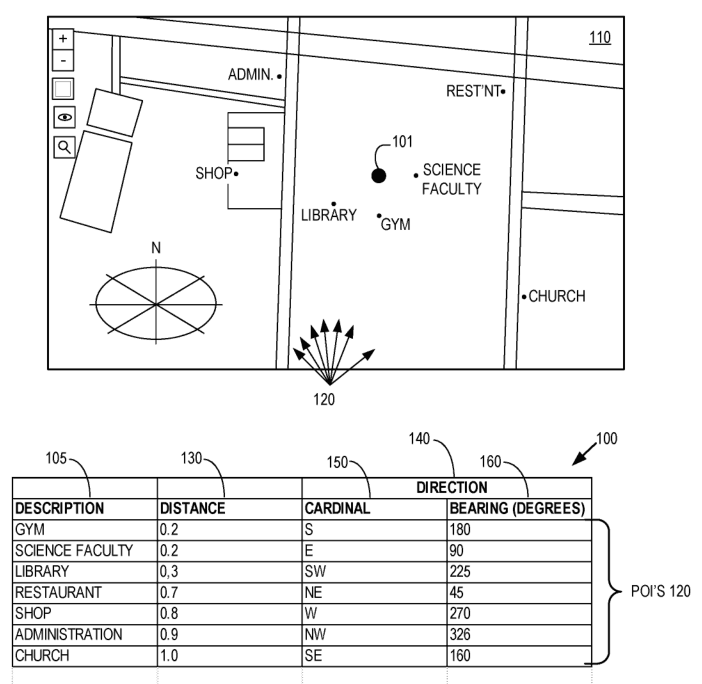
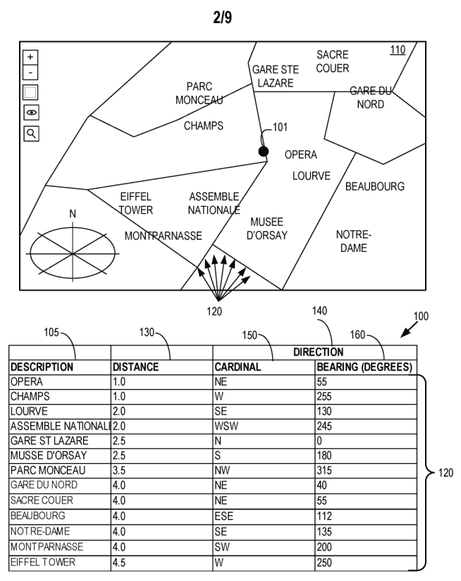
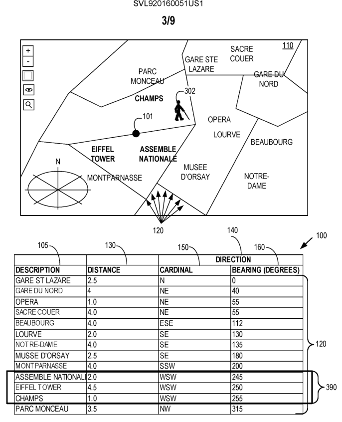
A method of geospatial guidance for sight impaired users includes receiving, by a computer system, a user selection of a geospatial area. The computer system further receives a user selection of a point of interest criteria. The method includes finding, by the computer system, in a database that includes geospatial points of interest, those geospatial points of interest that match the user selected criteria and that are in the user selected geospatial area. The computer system determines a reference location in the user selected geospatial area and distance and direction from each of the found points of interest to the reference location. The computer system presents sets of information, to the user, wherein each set includes a description of one of the found points of interest together with distance and direction between the reference location and the one of the found points of interest.
Full write-up available with Pro
Pro includes, for every patent on each weekly list: a written summary, the scope of the claims, materials and manufacturing route, a demand check with current listings and prices, and related-patent warnings.